


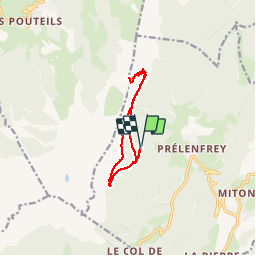
Prélenfrey - refuge des clots - rocher du ranc des agnelons

maupassant38
User

Length
10.7 km

Max alt
1953 m

Uphill gradient
754 m
Km-Effort
21 km

Min alt
1311 m

Downhill gradient
756 m
Boucle
Yes
Creation date :
2019-02-22 22:30:46.986
Updated on :
2019-02-22 22:30:47.002
4h36
Difficulty : Medium

FREE GPS app for hiking
 SityTrail
IGN / Geographical institutes
SityTrail Plus
The world is yours!
About
Trail Walking of 10.7 km to be discovered at Auvergne-Rhône-Alpes, Isère, Le Gua. This trail is proposed by maupassant38.
Positioning
Country:
France
Region :
Auvergne-Rhône-Alpes
Department/Province :
Isère
Municipality :
Le Gua
Location:
Unknown
Start:(Dec)
Start:(UTM)
704539 ; 4988096 (31T) N.
Comments